Now is the Time to Scout for Whitetails
Whether you filled your freezer with fresh venison or are dining on tag soup, deer season is over. This means it’s time to set the stage for next fall, right now.
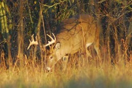
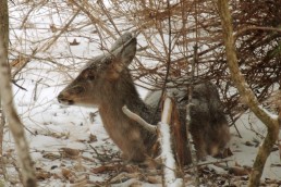
While most hunters forget about whitetails during the late-winter period, it has become one of my favorite times to scout. The influx of hunter’s orange into deer territory is gone and the animals have settled back into feeding patterns. Now is the perfect time to scout your deer hunting grounds. Most hunters wait until late summer and early fall to scout, when leaves are on all the trees and the understory is alive and thicker. Right now, the woods are wide open and fresh with late-season sign. Rubs and old scrapes will be easier to spot, not to mention fresh tracks on the best trails.
The property you hunt may be thousands of acres, or only five; more than likely it’s somewhere in between. You may have bedding areas, food sources, water, and travel routes all on one great place, or you may have only one or two of these to work with. The bottom line is: scout now, do your homework, so you can hunt smarter next season.
Scout with technology first
You’re probably very familiar with the land you hunt. You should also be familiar with the surrounding properties. Chances are, you don’t have permission to hunt or even access these areas. Thanks to modern technology, you can scout places that are otherwise off limits. You can look it over via free maps available on the internet or smartphone apps designed for the hunter. (See below for a list of my favorite map sites and phone apps.)
You can use these to view satellite imagery and see the land from a bird’s eye view, or choose the topo option and see the elevations to find ridges and drainages. Taking advantage of the latest and greatest can save you precious time when scouting your land and reveal what is on the places nearby. If you are old school (nothing wrong with that), you can do the same by getting your hands on some aerial photos and a real topo map.
If you are able, print out the satellite and topo views of your property and the surrounding area. Carry these with you when you go out to scout on foot.
Locate the places you think deer will travel to eat. I bet you already know where all the feeding areas are located on the property you hunt. Now it’s time to take a look at what’s around you. Zoom out and look in every direction at the properties surrounding you. Search for large stands of mast trees and locate any agricultural foods such as row crops, grains, or green fields. Even if the food source is a mile away, your resident deer may travel there to feed at night.
Deer will congregate around agricultural lands later in the season, when it is the coldest, and well past the end of hunting seasons. Keep in mind that deer will stage in wooded areas near farm crops and enter fields after the sun has set. The farm land may not be on property you have permission to hunt, but the staging area could be—or, better yet, the trail leading there.
Next, find any potential bedding areas. Search for these just like you did for the feeding areas. Even if you think you know your own hunting ground well, study it thoroughly with the satellite view. You may find something you have been overlooking.
Look for areas around your hunting acreage that may have been logged or even clear-cut. These will grow back and provide excellent cover where whitetails feel secure. CRP and overgrown fields are also on the list for good bedding areas. Even if the bedding area is not located on your piece of ground, the deer bedding there may travel through your property on the way to a food source.
Topo maps will reveal deep ravines and high ridges. Deer will flock to these places when it is cold and there are high winds. They will bed down in deep hollows, especially on a sunny hillside where the wind is blocked.
Search for the places your neighbors will hunt. Look on adjacent properties with the satellite view for food plots or green fields. Sometimes you can zoom in close enough to see hunting blinds. Try to predict where your neighbor will park and walk to his stand. Many hunters will do the same things over and over and the deer will actually pattern the hunter. With the right wind direction and stand placement, you can work this to your advantage.
Scouting tip
You have found something with either the satellite view or the topo map that you want to go check out. It may be a large stand of oak trees, a pinch point in the terrain, or even a high elevation looking down at a flat.
The best online maps to use for scouting will have the latitude and longitude coordinates shown somewhere on the map; it is usually in a small block at the bottom of the map page. The map will give you the coordinates of where your curser is located. Watch the coordinates change as you move around on the map page with your mouse.
Place the point of your curser directly on the spot that you want to go and check out. You now have the coordinates you need to get you right there. Write down the latitude and longitude then punch these into your GPS. This will get you there—spot on.
You can be among the first to get the latest info on where to go, what to use and how to use it!
Boots on the ground
Now that you have done a little homework and determined where feeding and bedding areas are, it’s time to get out in the woods. Nothing on the web or a map will ever take the place of getting out and putting your eyes on the deer sign and the terrain. Always keep a good compass and some type of GPS with you.
Keep up with whatever you find – I have to write it down. I usually keep a printed aerial photo of the area I’m scouting, and mark trails, rubs, potential stand sites, etc., and jot down notes on the backside.
The ideal situation from the deer’s perspective is to have a place where it can bed, feed and water without moving too far. Check out food sources first, especially any that could have a bedding area nearby. Walk around the perimeters of your food sources. Look for fresh tracks and well-used trails that enter it.
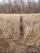
If you find a good trail entering a field, or a portion of the field loaded with tracks, ask yourself: where are they coming from? If you find a trail, follow it. What you’re looking for is a trail that goes from a bedding area to a food source. Find this and you’ve hit the jackpot.
If there are no trails, scout the area between feeding and bedding sites. You might find a rub line. Follow rub lines, for they will likely take you from a bedding area to a place where does tend to congregate—usually a food source.
Plan for stands
Now is the best time of year to find places to put your stands. You have seen all the fresh sign from late season. You know where the deer bed. You know where they feed. Before the spring leaves start to grow, you can find the view you want for this coming fall.
What is your style of hunting? Do you enjoy sitting and watching open fields where deer come to feed? Would you rather sit on the edge of thickets where deer bed, or somewhere between, on a trail? Whatever you prefer is the right answer. Scout for stand locations in the places you enjoy, places where you will sit longer.
Keep wind direction in mind when picking stand locations. Whether it is the food source, trail, or close to bedding areas, choose more than one location and be prepared for different winds. When a high-pressure cold front approaches, what is your predominant wind? When a low-pressure system is on the way, what direction are the winds? You have to know this to find the best stand sites.
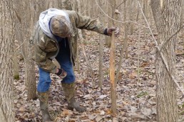
When you find that magic spot and you know a stand will be placed there come fall, mark it. You can save the coordinates on your GPS or tie ribbon on a tree, but mark it by some means. It will look a lot different in the early fall. Whether you plan to hang a climber on a tree or set up a ground blind, you will be able to trust the good scouting done now.
Evaluate your area
After all the scouting, walking around, stand planning, note taking, and map study, look at your hunting ground from the big picture. Lay out your paper map with everything marked up, or an online map with everything plotted. Look at your stand sites in relation to the feeding and bedding places. Double-check your strategy for different wind directions. Remember where your neighbor hunts as well. Plan now where you might park to access your stands. You might even have to construct some parking places.
You might see something else you want to go back and take a look at. It’s the right time to go. Make the trips now, so you can minimize foot traffic through your hunting ground right before the season opens.
There is no one-size-fits-all method for scouting your deer hunting areas. It could take years to learn everything about your place. It’s all up to you, in terms of how much time and effort you spend on it. But careful study and a well-laid plan is the surest path to a freezer full of venison come this time next year.
Favorite Map Sites:
My Topo – mytopo.com/maps
Bing Maps – bing.com/maps/
Google Maps – maps.google.com/maps
Google Planimeter – gravoplex.com/Planimeter/GMapPlanimeter
Google Maps Coordinates – mapcoordinates.net/en
Favorite Apps:
Antler Insanity
Hunt Predictor
Google Earth
Esri
Did you enjoy this post?
You can be among the first to get the latest info on where to go, what to use and how to use it!