Quiet Waters Rise off Bottom to Harbor River Fish Part Two
A discovery that will change the way you fish rivers (Part two of an exclusive three-part series)
Foreword: For about six years, Dan Gapen, the head river rat, and “Bobber” Anne Orth have been hard at work refining their understanding of a river-fishing discovery they made while testing a new lure called the Spin Bee. We are excited that they approached MidWest Outdoors about publishing their work; this is the second of three parts in an exclusive series just for our readers. We are also offering additional coverage of this “Gapen River Zones” concept on MidWest Outdoors Television, on the new MidWest Outdoors magazine-format podcast, on our blog at midwestoutdoors.com, and in our social media feeds.
This information will change how you fish in rivers. We aren’t aware of anyone else describing what you are about to read, and welcome comments and questions on our behind-the-scenes blog post, at midwestoutdoors.com/gapenzones.
Nearly six years have passed since I first discovered Benthic Zones in rivers. Much has been learned during that time. In part one of this series, I exposed how these river zones were discovered and some information on how and why they provide fish for you as an angler. Here, in part two, I’ll go deeper into the whys, wheres and hows, so you can really cash in on these slack-water zones.
First, it’s been my experience that water temperature, bottom structure and time of year have much to do with this new phenomenon. As we talk about these things, you can study the illustrations, to help you visualize the concepts.
First, a quick refresher on what a Benthic Zone is. It’s essentially any area along the river bottom where current either doesn’t exist, or is so gentle as to allow fish and prey items to hold without apparent effort.
In these zones, gamefish easily hold next to bottom, feeding on the numerous styles of food available. This food, in the form of minnows, crayfish, fly larva and hellgrammites, has retreated here for the sanctuary this void affords. It’s my guess that fish migrate, seek out, these slack-water Benthic Zones because food is readily available and it’s easy to hold in position. Another reason is that much of the river’s volume of silt is also found in this deeper-water region. Silt provides spawning and hatching habitat for “fish food,” and these silt and gravel pockets produce microorganisms needed to feed the fish food.
To understand my theory better, look at Diagram C, where I depict a typical Benthic Zone. These are found throughout any river you fish. This one is 10 to 12 inches deep with a flowing current over it as much as 20 feet in depth. You’ll note where I’ve indicated at C-1 a series of small rocks, pebbles and sand pockets on bottom where crawdads and fly larva are present. This is ideal fish food for the gamefish coming up at C-2.
You’ll also note, at C-1, that bottom sweeping current is raised upward to begin a Zone. Later, in diagrams F and G, I show how large these Zones become as river water temperature rises.
In diagram D, I show you how fish hold in a zone when small bottom indentations occur. In both of these, you’ll note that small stones, or gravel patches, will birth a zone. In D-1 there is a stone pocket, which will host the largest fish in this stretch of river. The pocket, noted only on surface above by a small boil, is a collection point for live bait swept downstream. That’s the reason the larger fish stay here.
Upstream from the pocket, most of the fish staging will be much smaller. Discovery of these pockets is done mostly by noticing the surface boils, but with a sonar unit, you can also see such a pocket’s existence.
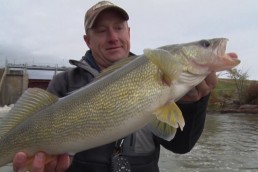
Casting to this spot can be done by presenting your lure or bait way upstream from the surface boil. But in my opinion, a better way to fish it is to troll across the spot. My favorite bait for trolling this type of zone is a Spin Bee, as I mentioned in part one of this series. Rivers such as the Wisconsin host many of these channel dents, as diagram D shows, because of multiple sand flats.
How high do zones rise?
Here, I must tell you that river zones can reach up as high as about 18 inches off bottom. Some are as “short” as 4 inches high. In all cases, getting your presentation down on bottom is the key to catching fish. Oh, small gamefish, such as smallmouth bass, will rise up and break out of the zone sometimes to hit a lure passing overhead. But for the most part, big fish, especially walleyes, will avoid doing that, preferring to hold close to bottom, and ignoring things that pass by in the faster current. They have all the food necessary right down in the zone.
Rocky-bottom rivers, such as the upper Mississippi, is where I do a lot of my fishing. See diagram E, which best shows typical zone makeup in these types of rivers.
I’ve taken a 3-foot-deep section where huge rock structure and a silt/sand flat exist. Right away you will note I’ve marked a rather large gamefish holding just upstream from the huge rock, where the diagram is marked E and water is but 3 feet deep. Why is she there? This larger fish is holding there to get first shot at downstream-tumbling food. Minnows, larva, crayfish, and hellgrammites carried on the current have to pass her. There is a natural roll-back of the current ahead of the boulder, providing an easy hold for this fish.
You can be among the first to get the latest info on where to go, what to use and how to use it!
At E-1, you’ll find all those critters that managed to avoid that upfront big female fish hiding in the rock jumble. It’s an excellent spot to find feeding smallmouths, which would normally stage at E-2 to travel up and catch a meal.
Once you move your presentation downstream from E-2 into the silt/sand flats, larva will greatly impact what size and species of fish are found. Generally, this region holds smaller gamefish and roughfish species that feed on fly larva.
In all three of these diagrams (C, D, E), the use of a walking rig, such as a Bait Walker, loaded with nightcrawlers or minnows, will product best when you are anchored above the targeted zone. If it’s an artificial lure such as a crankbait, or one of the newer baits like a Spin Bee, trolling will be a great option. In the case of the Spin Bee, my favorite trolling bait for rivers, you have the flash of the tail spinner working for you as well as the scent of the 3/8-inch piece of ‘crawler, and striped bee color pattern of the body. These features will normally outfish a crankbait or plain jig.
Overhead perspective
Now let’s look at the “aerial” view of river zones. See diagrams F and G.
In diagram F, we have a typical spring river stretch of river. You’ll note water temperature ranges from 50 to the high 60s F. Zones 1, 2, and 3 are all much smaller than when shown in diagram G.
Why? I’m not sure, but it seems these dark-water Benthic Zones increase in size dramatically as the water warms. I’ve asked a couple biologists why this is so, and received a big wordy answer. However, they were both surprised that I knew of these river features, thinking only “academics” knew of such advanced matters. I learned these facts by trial and error, lots of underwater video footage and a persistent partner named “Bobber” Anne.
Look at diagram F, Zone 1. The spring fish—we’ll say they’re walleyes—are crowded into a small zone below a rapids. Here, you’d find them spawning in spring. But as water temps rise, this zone extends downstream, covering a much larger area, allowing the spring walleyes to move around and hold, with little or no effort, in a larger piece of real estate. The reason they come is that food has now migrated into these larger zones.
Please note in diagram F that many of the gamefish are scattered throughout the stretch of river, along its shoreline and in its eddies.
Even after a number of years spent studying these slack-water river zones, I’m still learning. One thing I’m sure of is that they exist as I’ve described, and that water temperature has an effect on their formation and size. And that presenting your lure or bait as close to bottom as possible is critical.
I’m sure there are more zone secrets to be found. By the way, during summer and fall of 2015, Anne and I came onto some new mysteries that we are now investigating. I’ll go into more details, more proof, and a better explanation once we feel comfortable in our knowledge. At 84 years young, these river zones excite me. We will pass along new findings in future issues of MidWest Outdoors.
In conclusion, my advice is to get away from a single-minded focus on shoreline spots in rivers! Head out into the midstream regions and work the bottom. Try anchoring above productive Benthic Zones and fishing with a live-bait rig, but also try trolling artificial lures, moving them very slowly upstream through the zone.
One last thing. If any of you are excited by this information, or disagree with me, I’d love to hear from you. You can reach me by leaving a comment at the blog post found at midwestoutdoors.com/gapenzones.
Until next time, when more Zone secrets are unlocked, I want you to relax, savor, and enjoy our great outdoors. It’s yours to save and protect for future generations.
For more information…
For more river know-how from Gapen, check out the book, “River Fishing, a Happy World,” available at gapen.com.
Subscribe to MidWest Outdoors magazine to find these detailed maps and other fishing and hunting articles and information.
Did you enjoy this post?
You can be among the first to get the latest info on where to go, what to use and how to use it!