Fishing the Thermocline
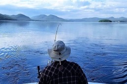
When the summer heat sets upon his favorite lake, John Murray targets the thermocline for fishing success.
Predawn summer fog indicates that something magical is occurring in the depths of the lake. This magic is routed in science. The warming of the lake’s surface water has begun a scientific process of creating fantastic fishing opportunities.
As the surface temperature of the water has warmed, molecules within the surface water become less dense, and this creates a condition below the surface known as a thermocline. A thermocline is a thin layer of water that has dramatic, rapid temperature changes when compared to the water above and below. This thin thermocline layer may often be only three feet in thickness, but it creates a barrier between two distinctly different layers of water. The warmer surface water above the thermocline is called the epilimnion layer, and the cold layer below the thermocline is called the hypolimnion layer.
Thermocline layers are most often found at depths of 10 to 40 feet in the water column. As a rule of thumb, thermocline layers will be at different depths because of the clarity of the water, and how far the sunlight can penetrate into the depths. In a lake with a murky appearance, the thermocline layer will be closer to the surface; in a lake with crystal clear water, the thermocline layer will be deeper. This is a good guideline, but a successful angler needs a better way to determine the exact location of a thermocline layer.
Finding the thermocline
From the surface of the lake, the thermocline is invisible to the eye. But, if you were to swim into the depths of the lake, a visually acute person could possibly see the thermocline layer, which would have the appearance of distorted glass with a wrinkled surface. It will also have a greenish or milky white tint, and this is because of the miniature zooplankton that have taken up residence along the layer. An underwater swimmer would most certainly feel the dramatically cooler temperature difference upon entering the layer. Suddenly, it’s going to get a heck of a lot colder.
A finely tuned sonar unit can show the location of the thermocline layer. With the sensitivity of the unit turned up to 90 percent, and set on manual, the layer can be seen as a fuzzy line. If the sonar unit isn’t able to show the thermocline layer on the screen, the sonar will certainly be able to spot the location of the fish that will congregate and hold tight to the top layer of the thermocline. Many fish, large and small—including schools of baitfish—will be suspended at this layer.
Another way to determine the location of the thermocline layer is to lower a temperature gauge into the water. Initially the gauge will show nearly uniform water temperature from the surface downward. When the temperature gauge reaches the thermocline layer, the gauge will show a dramatic change in cooler temperature. This will be the upper portion of the thermocline. As the gauge is lowered through the thermocline layer, the temperature will continue to drop. Some thermocline layers can have a temperature drop of nearly 10 degrees from top to bottom. When the temperature stops dropping, and levels out a constant temperature, this is the bottom section of the thermocline layer.
You can be among the first to get the latest info on where to go, what to use and how to use it!
A perfect neighborhood for the fish
Summer heat can easily bump up the surface temperature of many lakes into something that feels like warm bathwater. While the fish can venture into this warmer zone to forage for food, they would much prefer cooler water. Not only is the cooler water more pleasant to the fish, but this water is also highly infused with oxygen, and the fish require this oxygen for survival. The top layer of the thermocline has both cooler water and high oxygen content. There is also plenty of food in the thermocline area, and this starts with the zooplankton. There will also be many tiny baitfish that will congregate in this area to feed on the zooplankton. Bigger fish will feed on the baitfish, and larger fish will be present to feed on the big fish.
While the top layer of the thermocline is the perfect neighborhood for the fish, below the bottom of the thermocline layer is another story. The thermocline actually acts like a barrier, and the water below the thermocline layer is often devoid of any oxygen content. With the dead zone below the thermocline, fish may venture into this section of water, but will certainly not linger there.
Fishing the thermocline
To optimize success, I fish the upper layer of the thermocline, and upward to about 5 feet over the top of the thermocline layer. Most fish will be in this zone. Trolling through this depth, or casting into with sinking lures, will be highly productive. Using a frequent turning motion when trolling will make the trolled lure or plug irresistible to the fish. If casting, use the countdown method when the lure splashes into the water. Sink rates will vary with fishing line diameter and lure weights, but many lures will usually sink approximately 1 foot per second. If the target zone for your lure is 10 feet below the surface, count to ten seconds to present that sinking lure into the desired fish zone. If you are trolling or casting, remember to use a dark-colored lure or plug in water that is very deep. The fish will be able to see it better.
Prime fishing areas occur where the thermocline layer makes contact with underwater structure. Excellent locations are sunken islands and humps, and alongside steep drop-off edges rimming the edges of lakes. Combining structure with thermocline creates a definite sweet spot that anglers can’t ignore.
Want to improve your fishing success this summer? Subscribe to MidWest Outdoors here.
MWO
SHARE THIS POST
Did you enjoy this post?
You can be among the first to get the latest info on where to go, what to use and how to use it!